
Mount Rainier National Park News
Map to access and conditions
All monthly reports
MPG V2.8, January 2013
Current Season Conditions and Photo Opportunities
February 2013
The purpose of this Web page is to provide some general monthly and seasonal conditions in Mt Rainier NP. It's not meant to be completely accurate or updated, see the other news and access Web pages for that information. It is meant to be a general guide to help you visit to the NP. Much of the information has been gleaned from a variety of sources, often from trip reports, conversations with experienced people, Websites, news stories, etc.
Conditions
The NP is in full winter operations, see access and conditions for information about the NP. The Nisqually entrance in the southwest is the only entrance open through the winter, all the rest are closed for the season as is the north-south highway (410 and 123) over Cayuse Pass on the eastern side of the Cascade Mountains.
In addition there are restrictions on roads and for travellers through the winter. The first of these is that all vehicles must carry chains while in the NP. Chains are readily available at almost every tire store in western Washington, many with return policies in the spring if they were not used during the winter.
Out of state and international travellers.-- This also means visitors coming to the area and renting vehicles must ensure the vehicle has chains. This is often a common practice with car rental agencies in the winter, but it is best to always ask and ensure chains are included in the rental and vehicle.
The second restriction is the road between Longmire and Paradise is controlled in two places. The first place is a gate about a mile east of Longmire. The gate is closed to uphill traffic everyday at 5 pm and not reopened in the following morning except Tuesdays adn Wednesdays, see note below, until the road is checked and cleared for travel. You can check the status each day with the NP's Twitter account.
The second place is just west of the Nisqually Bridge before the uphill road to Paradise where restrictions will be enforced for vehicles for proper tires, and chains based on road conditions and the weather between the Nisqually Bridge and Paradise.
Note.--The road above Longmire to Paradise is closed on Tuesdays and Wednesdays through the winter of 2012-13, until later in the spring, depending on the snowpack and weather. Anyone at Paradise after the gate is locked on Monday will not be permitted to leave until Thursday morning after the road is open. This is new this year so please plan your trip with this in mind.
An additional restriction either on the road from Longmire to Paradise or for the NP at the entrance is when emergency conditions such as landslides close the road or situations occur when and where search and rescue efforts are being conducted in the NP.
Winter News:
The weather is winter at all elevations;
The day and night temperatures will be cold at night to cool to cold during the daytime
dependent on the weather from sunny and cold to overcast with rain or snow;
The facilities are open at Longmire and only open weekends at Paradise,
all others are closed for the season;
The people will be few with slightly more weekends.
This winter all the trails have snow to some depth depending on the seasonal and daily weather with rain/snow storms and the existing snowpack. There will be less snow in some areas of the NP, such as the Carbon River valley and the Longmire area. For any trail you should check the most recent trail conditions for the trails you're interested during your visit but still be ready for unexpected weather and trail conditions.
One important note. Please stay on the designated trails when hiking in open fields or across meadows and don't wander off because of bad trail or snow conditions or to get some photographs. These areas are sensitive to damage in the spring and may not recover for summer season.
You can check the latest weather site data for weather and snow conditions and the NPS and State Department of Transporation Websites for road conditions.
Note.-- With the winter weather and conditions arriving, this still means you should plan, get the most recent information, be prepared for quick and severe changes in the weather and conditions and be flexible with your plans and schedules, especially when and where the NPS issues advisories.
Photo Opportunities
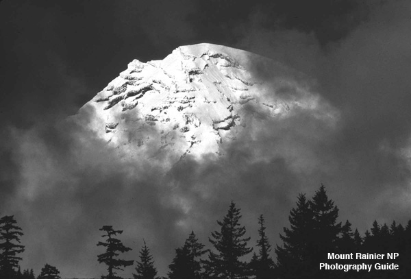
The photo opportunties in January through March are good for winter photographers. There are lots of excellent nature and landscape scenes everywhere, many outside the popular areas. The open tourists areas are less crowded, except on weekends and holidays, as are the trails all will have little to significant snow.
This is also the time you can get winter scene photos as snow will be present to some depth at elevations above 2,000-3,000 feet through most of the winter. You can check the latest weather conditions on the Mt. Rainier map of weather sites. The lower elevations are excellent for forests scenes with the background of snow on the upper elevations and Mt. Rainier.
Despite all of them shuttered for the winter, a good destination photo hike are the four fire lookouts in the NP along with two just outside the NP on the south and north sides. You should first check ahead for the snow conditions on the trail to the lookout.. You can get a description of them and locate them on a map. They provides excellent vista of Mt. Rainier and the entire 360 view of the NP and area.
You can get additional information about areas by quadrant and Paradise area in the detailed descriptions, currently Paradise area, southwest area and northwest area are available, while northeast and southeast are in preparation to be ready later in 2013.
Another photo opportunity are on the highways approaching Mt. Rainier. On clear days the mountain should provide an excellent subject or backdrop for scenes around the NP. This is outside the scope of this photo guide, but doing some exploring of roads can provide some excellent views of the snow-capped mountain.
Photo Prospects
Despite the winter weather the month still has some good photo opportunities for many winter scenes and landscapes. The problem in the month is access where winter has very dynamic winter weather from sunny and clear, overcast with rain and snow. Although not common the month also has the possibility of extreme floods where areas and even the whole NP is closed from damage.
That said there are many opportunities if you are prepared for the range of weather conditions and are flexible with the changing weather and conditions. These include the lower elevation forests, the waterfalls and lakes, and snow scenes at all the elevations. But remember the days in the NP are still short, see sun times for daylight hours.
Another great photo prospect winter are the many open meadows and alpine areas, above 5-6,000 feet elevation when the weather permits. The bushes and trees are under winter snow I have to stress one point.
Stay on the designated paths and trails in the meadows and open areas
and follow all the winter rules for backcountry travel..
Unless there is sufficient overlying snow it is easy to damage the underlying vegetation when the snow melts in the spring. In addition you will run the risk of being given a ticket by a Park Ranger for violating the rules (which all visitors accept when entering the NP).
The other prospect for nature, landscape and scenery photography are up to your imagination and willingness to go and explore off the roads on many of the trails, many accessible via day hikes, see map of hikes. Just remember wear appropriate hiking clothes and boots, and carry the basic backpacking gear and supplies, including the ten essentials, and be prepared for sudden changes in the weather and conditions.
If you play backcountry travel during the winter, you should become familar with the information, guidelines and rules for winter backcountry travel and camping in the NP. The risks multiple during with winter not to know, understand and follow the rule.
The last prospect are the many areas open with a backcountry hike, see map of information, meaning an overnight or longer hike into the more remote areas of the NP. This is where many of the less photographed and more beautiful scenes can be found and captured. But these are for the experienced backcountry hiker, especially solo, and with planning for the trip and camping permits for your overnight stays.
If you plan a hike into the backcountry, the NPS may have issued an advisory on the backcountry trails, see press releases. In addition there are rules for hiking the Wonderland trail. With the above normal snowpack this year high elevation trails will have more snow and the weather will be cold. It's the same adage about the NP, be prepared.
That said many of the best photo opportunities are in the backcountry areas, often 3-5 day round trip hikes. In addition many more areas are off the trails in the cross-country zones of the NP. Some suggestions are listed below and you can view a map of the areas along with the rules for the zones.
Photo Locations
February through April are the months of full winter closures and operations. You can get the latest news and location information.
The winter closures limits access to many areas in the NP as roads, facilities and campgrounds are closed. That said there are still a number of photo opportunities in February for all photographers, winter and snow scenes in the mid-to-upper elevation and forest scenes in the lower-to-mid elevations. This is further described by area.
Northwest Area.-- The Carbon River valley is usually snow-free below 2,500-3,000 feet for most of the winter except for occasional major snow storms, leaving many opportunities if you're prepared for colder, wetter weather. This provides many winter forest scenes.
The Mowich Lake road is closed at the boundary (gate) and open to hikers and later snowshoers and cross-country skiers when snow is present. The campground is open to winter camping with a backcountry permit. This provides many scenic landscapes of the mountains, lakes (Mowich and Eunice) and trails to remote areas both before and after the snow falls and then stays.
Northeast Area.-- This area is restricted to highway 410 closed at Crystal Mountain Boulevard, but open to hikers (snowshoes, skis) and snowmobiles. The White River road is open to all foot traffic and snowmobiles to the campground. This provides opportunities similar to Mowich Lake area following the White River valley.
Southeast Area.-- Similar to the northeast area, access is closed at the NP boundary, but open to winter travellers, either hikers (snowshoes or skis) or and snowmobiles along identified stretches of highway 123 and 706.
Southwest Area.-- This is the only area that is maintained for ready public access with visitors facilities at Longmire (all open year around) and Paradise (visitors center weekends and holidays). This provides a wealth of prospects from the low elevation forest through the mid elevation transistion to the upper elevation snow, especially along the highway with many turnouts and trailheads.
Paradise Area.-- This area is only accessible from the southwest (Nisqually) entrance through the winter. It is also the most visited winter area mostly for the snowplay area later in the winter and the easy access for snowshoers and cross-country skiers. The limitation for photographers is simply the sheer quantity of snow limits access for many scenes outside the visitors area and along the road unless you're experienced with backcountry winter (snow) travel and camping.
Advisories
Winter Floods.-- While November-December are the months of the worst floods in the NP, floods can occur in mid-late winter, see recent years (PDF) of the 2006-2008 floods. These floods are caused by rain-on-snow or snowmelt events with major, warm rain storms when there is a significant snowpack on the ground, which melts and adds to the runoff in the streams and rivers in the NP causing major damage to roads, trails and facilities.
Streamflow.-- You can check the streamflow conditions for the rivers in Mt. Rainier NP with the USGS real-time streamflow data for Washington state. The NPS will close the entrances to the NP during the worst of the floods when and where roads and facilities are at risk.
Advisory about Trails.-- In late winter into spring and during adverse weather in meadows and open areas, it is important to minimize the danger to vegetation, expecially wildflowers and low vegetation, and as such please follow this rule.
Stay on the designated paths and trails, especially on the snow, where flagged.
This is critical in the popular areas and on the trails in the Paradise area. This is less critical in the backcountry where many of the trails are already established.
Advisory about Guns.-- Beginning February 22, 2010, openly carrying guns in the NP is legal and concealed with a legal permit. However, there are a number of conditions, which you can find here with links to additional information.
It is illegal to carry a gun indoors and it is illegal to use or fire a gun anywhere in the NP.
This is especially important in the visitors areas, the campgrounds, on the trails, and in the backcountry. You can only openly carry a gun or concealed with the proper (state permit) and nothing else. You can not unholster, use or discharge the weapon anytime or anywhere in the NP. The NPS has trained and instructed the park and backcountry rangers to treat all visitors as if they are carrying a gun unless it is clear the visitor is not carrying a gun.
Conclusions
Winter is the best season for winter photographers, but just be prepared for dynamic weather and some to deep snow throughout the NP except for the lowest elevations. Many photo opportunity are there, so there is a wealth of places to go, look and capture.
Please enjoy your visit to the NP and follow the old adage, Leave No Trace. We'd all like to enjoy it in your footsteps without seeing your presence.
You can can get reports for previous months here.
Please use the contact link to send e-mail.