
Photography Places in Mt Rainier NP
Find photo places via a map and
rovers map
MPG V2.8, January 2013
Sections
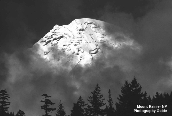
Washington (state) has a variety of photographic places depending on the photographer's interest. One of the most photographed places is Mt. Rainier National Park with 1.7 to 1.9 million visitors annually. While many visitors aren't serious or professional photographers, almost everyone takes pictures of their visit, and where many of those photographs are just to document their visit, some photographs are taken to market the images.
That doesn't mean visitors don't want to photograph scenic places in the NP or don't want the best photographs possible. While no book has yet to fully address those interests, a recently published book by Greg Vaughn comes close, "Photographing Washington", Phototrip USA Publishing, 2013. The book has a chapter on Mt Rainier NP, which is an excellent resource for every visitor, and especially photographers for the best photographic opportunities in the NP.
When people ask where are the best places to photograph in Mt Rainier NP, the common answer is simple, "Anywhere and everywhere.", but that's too simple as everyone, and every photographer, has their own interest and goals in photography. This is where the book (above) presents the diversity of opportunities in the NP, which are presented and summarized here, and with a map, but I would highly recommend the book for the author's description and recommendations before visiting the NP.
The book describes fifteen areas in the NP which are divided into seventeen areas, excluding the Wonderland Trail which is not travelled or photographed by most people and deserves it own more extenstive description and map, adding on area, and dividing two areas into separate areas. This leaves the seventeen areas, places being specific locations and locations being general places with multiple places in the area.
The areas and places are presented by the quadrant associated with their respective entrance(s) to the NP, which are the southwest (Niqually entrance), southeast (Ohanapecosh-Stevens Canyon entrance), northeast (white River entrance) and northwest (Carbon River and Mowich Lake entrances), and the Paradise area in the south-central part of the NP accessible from 3 (SW, SE and NE) entrances.
These are displayed on the map by catagories, as an entrance, places accessible via a trail, a location with several places in the area, being facilities, campgrounds, reststops, etc., and places for waterfalls or lakes.
Whether photography is your goal with your visit to the NP or incidental as part of your hike(s) or visit it pays to spend some time thinking about the photography you want to do and the photos you want to take home to give yourself the maximum opportunity for the best photos. There are four considerations with the planning and preparation, the when, where, how and what, which becomes the plan for your photography in the NP.
The first, the when, starts with time of your visit, the season. This consideration is important since the weather and conditions in the NP varys throughout the year as with each year, as we have seen in recent years with 7 of the last 10 years with above average snowpack and two just below average, and 2014-2015 winter with a record low snowpack and early snowmelt and with a record warm summer with very little rain.
The seasons in Mt Rainier NP are distinct with varying transitions betweens the seasons, and varying each year, meaning the history of the seasonal weather is only a general indicator and not necessarily true for any given year. There is a wealth of information available to know the condition of the current season, the changes for the next season, and the prospects for the upcoming season, but forecasts are just that, forecasts, and not always accurate beyond the general sense and possibilities.
Most visitors and photographers visit Mt Rainier NP from the Memorial Day holiday weekend, when many of the areas and facilities in the NP begin to open for the season, through the Labor Day holiday weekend, after which the NPS plans and prepares to reduce days and hours to closing areas and facilities for the winter season.
Some visitors, especially winter visitors for the snow, prefer the other three seasons in the NP where there are far fewer people, more dynamic weather and a diversity of conditions from fall through winter into spring, and despite fewer open areas and restricted access, the NP offers more photography opportunities.
This means the photographer has to plan for the weather and conditions from early fall to late spring, or for the summer season when and where everything is open with the crowds and hikers, but with the more consistent weather for the wildflower season from June through August. Either way, planning is essential and leads to the next factor, the where.
Most visitors, and especially photographers, would be hard pressed to initially decide which areas, locations and places they want to photography in the NP with any certainty outside of the few very commonly known and often photographed ones, but Greg Vaughn in his book has succeeded better than anyone to present excellent choices of areas, locations and places to photograph with your visit and photography.
This section, with the accompanying map, will describe the areas, locations and places with some variations from the book (above) to expand some locations into separate ones. These are distinguished and presented on the map as an NP entrance, location with multiple places, places for trails, and places for waterfalls or lakes so photographers can better judge where they want to visit.
Nisqually entrance to Longmire.-- The Nisqually entrance in the southwest corner of the NP is the most visited entrance and the Longmire area the most visited location after Paradise and Sunrise. It has a variety of places from the entrance to Longmire and in the Longmire area, which includes facilities, with a museum, visitor center, inn, restaurants, store, and roadside rest stops.
This area also includes a variety of place to photograph with views of Mt. Rainier and trailheads for short or day hikes to more of the NP, longer hikes into the backcountry, and parts of the Wonderland Trail, opening the entire southwest area of the NP to hikers and photographers.
The trails include the Kautz Creek trail to Indian Henry's Hunting Grounds, Twin Firs, Trail of the shadows, Rampart Ridge, which also goes to Indian Henry's and other trails to Van Trump Park, the Wonderland Trail, and Eagle Peak. The area also has the Westside Road.
Westside Road.-- The Westside Road begins about a mile past the Nisqually entrance and goes for about 3.5 miles to the Dry Creek trailhead where the trail continues on the now only open to hikers and bicycles on the Old Puyallup road, which in turns leads to trails to the whole western side of the NP north to Mowich Lake and northeast to Paradise.
Comet Falls, Van Trump Park and Mildred Point.-- The trail to Comet Falls, Van Trump Park and Mildred Point is one of the hardest day hikes for elevation gain over distance in the NP from the trailhead between Longmire and Christine Falls. The trail is longer from the trail off the Rampart Ridge trailhead east of Longmire.
Christine Fall.-- Christine Falls is accessed from the parking along highway 706 east of Longmire. The viewing area is on the southside of the highway from near the trailhead to Comet Falls and Van Trump Park.
Narada Falls.-- Narada Falls is accessed from the turnoff off highway 706 east of Longmire to the parking area and picnic area to the trailhead for the short trail to the falls.
Paradise.-- The Paradise visitor center and area are the most visited area in the NP, especially between the Memorial Day holiday and Labor Day holiday weekends, so planning is essential for your visit during this period, but outside of summer there are far fewer people, and more so on the trails beyond the first mile or so.
The Paradise area offers great views and photo opportunities from the parking lot and the short trails from the visitor center to Nisqualy glacier overlook, meadows and wildflowers, vista of the surrounding area and Mt Rainier itself, which you can locate on a map of dayhikes.
Inspiration Point.-- Inspiration Point is a turnoff and parking area from highway 706 just past the turnoff to Paradise and east along Stevens Canyon Road (continuation of highway 706). It offers visitors and photographers a vista of Paradise Valley, the Nisqually River valley to the southwest and Mt Rainier to the north.
Inspiration Point is also accessible from Paradise via the Paradise Valley road east of the parking lot at Paradise. The one-way road goes around the north and east side of Paradise Valley to the intersection with highway 706 east of Inspiration Point.
Pinnacle Peak.-- The Pinnacle Peak trailhead is off the Stevens Canyon road, west of and opposite Reflection Lakes turnout for parking. The 2.6 mile trail offers excellent vistas of Mt Rainier and the whole surrounding area north and south beyond the southern NP boundary.
Reflection Lakes.-- Reflection Lakes (larger and smaller lakes) and Lake Louise are the most photographed place in the NP after the Mt Rainier itself. The lakes are accessed from the parking lots (turnouts) along the Stevens Canyon Road east of Paradise. The best time are around dawn and sunset with little or no wind.
Stevens Canyon (Road).-- The Stevens Canyon road, highway 706, runs between the intersection of the highway with the turnoff to Paradise and the intersection with highway 123 at the Stevens Canyon entrance. The highway has a variety of opportunities from turnoffs for scenic views of the valley, lakes and Mt Rainier, parking for trailheads to waterfalls, forests, and rivers, such as Grove of the Patriarchs and Box Canyon.
Grove of the Patriarachs and Box Canyon.-- The Grove of the Patriarchs is accessed from the parking lot on Stevens Canyon Road west of the NP entrance to the trailhead to the bridge over the Ohanapecosh River and the Grove of the Patriarchs. Box Canyon is accessed from the trailhead at the parking lot at the tunnel at the Muddy Fork of the Cowlitz River. The picnic area is a short distance west of the parking lot.
Ohanapecosh Hot Springs.-- The Ohanapecosh Hot Spring area has a visitor center, campground and several places with waterfalls and trailheads to the backcountry in the southeast are of the NP and to the Pacific Crest Trail southeast from the NP and north along the eastern boundary of the NP and the William O. Douglas Wildeness area.
Cayuse Pass and Tipsoo Lake.-- The Cayuse and Chinook Pass areas offers several opportunities for visitors and photographers with the picnic area and extraordinary views of Mt Rainier and the east side of the NP and vistas of the area east and west of the Cascade Mountains. In addition there are trailheads north and south from Cayuse Pass and Tipsoo Lake for dayhikes or the Pacific Crest Trail.
Sunrise.-- The Sunrise area is the second most visited area and has a visitor center, snack bar, picnic area and walk-in campground with a number of trails originating at the visitor center to the immediate area, the backcountry, the Wonderland Trail and the glaciers on the north and northeast side of Mt Rainier.
Carbon River.-- The Carbon River area is the only one which doesn't have road entrance and access into the NP. It is only open past the NP entrance to hikers to the whole north and northwest areas of the NP and to mountain bikes on the Carbon River trail to the Ipsut Creek campground (~5 miles) but not any side or connecting trails.
This is due to floods in the winter of 2006 and 2008 which caused extensive damage to the Carbon River road forcing the NPS to close it permanently and rebuild the road and trail into a single trail for hikers and bikers. There are numerous side trails to the whole northwest area, including glaciers and meadows, and connecting to the Wonderland Trail.
Mowich Lake and Spray Park.-- The Mowich Lake area has one main photo opportunity with Mowich Lake with Eunice Lake a short hike away. There is a parking lot with picnic area and primitive campground, along with trailheads to the many trails in the northwest area of the NP including Spray Park, one of the best meadows in the NP and many open areas for views of Mt Rainier.
It is difficult to write any specific information in doing photography in the NP for two reasons. The first is the variety of photographic opportunities there, such as wildflowers, meadows, landscapes, forests, glaciers, waterfalls, Mt Rainier, etc., along with the range of light from the bright days of summer to the low light or overcast days of winter with rain, fog, snow, etc.
The second is the variety of photography equipment, from cameras in smart phones and tablets to the most sophisticated professional equipment, icluding large format camera and lenses. That said, I have written a brief description of photo suggestions from my experience and knowledge which the lens recomendations can be converted from 35mm (full frame) format to other format sizes, eg 0.6 for APS, 1.6x for 6x6 or 645, and 3.6x for 4x5 formats. This does not, however, account for the two important factors in photography, timing and light.
Timing and light are the two factors photographers only have some control in nature or landscape photography, in Mt Rainier NP, in part because Mt Rainier makes its own weather with the current weather, and so the photographer has the challenge to adapt to the weather and available light, even with the computer tools and applications for information or guides.
There are a wealth of applications for laptop computers, smart phones and tablets for hikers and photographers, either for Mt Rainier NP or including Mt Rainier NP, some of which are described here. The other applications fall into two catagories, sun and moon light, and weather applications.
You can get weather information for Mt Rainier NP from the various sources, either the federal government agencies or commercial companies, or for the weather sites operated by the National Park Service, National Weather Service or Natural Conservation Resources Service in and around Mt Rainier NP, found here.
With the information about where you want to visit and photograph, and with the information about the light and general weather conditions (existing or forecast), what's left is the travel to the NP and the weather you will encounter, the latter being less important during the summer but important, even critical, from fall through spring.
Mt Rainier NP is accessed through 5 entrances, one in each of southeast, northeast and southwest quadrants, and two in the northwest quadrant, which are described here. The entrances are accessed from different directions via highways, described here.
The southwest area is accessed via highway 706 off highway 7 at Elbe, south of Tacoma. The northwest area is accessed via highway 165 from Tacoma or Seattle through Wilkeson. The northeast area is accessed via highway 410 from Seattle to the north or Yakima from the east. The southeast area is accessed via highway 123 off highway 12 between Packwood and White Pass.
In the NP highway 123 connects with highway 706 at the Stevens Canyon entrance and with highway 410 at Chinook Pass. This connects the Paradise area with the northeast, southeast and southwest entrances allowing visitors to take a long scenic trip around three-quarters of the NP.
With all the entrances and routes to get to the NP and around in the NP, the important consideration is travel time for your visit, which depends on the time you have for your visit and if you plan a day trip or plan to stay at one of the two inns or at one of the three campgrounds in the NP, at an inn or at a campground outside of the NP, or accommodations some distance from the NP.
To assist visitors and photographers the information of the places to photograph in the NP is also available in a map of places in the NP. The map is a guide to the locations described here and in the book with the basic information about the places. Visitors and photographers are advised to consult the book and other sources listed in the resources section below.
In addition photographer Tom Haseltine has published two pamphlets for places to photograph in the NP, divided into the northern and southern halves of the NP. The southern map pamphlet was published before the new Jackson visitors center opened in 2008, so the user needs to take that into account, which the book has the latest information.
Advisory about Trails.-- During the summer in meadows and open areas, it is important to minimize the danger to vegetation, expecially wildflowers and low vegetation, and as such please follow this rule.
Stay on the designated paths and trails, especially on the snow, where flagged.
This is critical in the popular areas and on the trails in the Paradise area. This is less critical in the backcountry where many of the trails are already established.
Advisory about Guns.-- Beginning February 22, 2010, openly carrying guns in the NP is legal and concealed with a legal permit. However, there are a number of conditions, which you can find here with links to additional information.
It is illegal to carry a gun indoors and it is illegal to use or fire a gun anywhere in the NP.
This is especially important in the visitors areas, the campgrounds, on the trails, and in the backcountry. You can only openly carry a gun or concealed with the proper (state permit) and nothing else. You can not unholster, use or discharge the weapon anytime or anywhere in the NP. The NPS has trained and instructed the park and backcountry rangers to treat all visitors as if they are carrying a gun unless it is clear the visitor is not carrying a gun.
There are far more knowledgeable and experienced photographers for doing photography in Mt Rainier NP, and there are far more knowledgeable and experienced scientists and professionals about Mt Rainier and the NP, so I suggest looking at the resources below and the library of materials I have on Mt Rainier and the NP.
There is so much you have to research and focus on what interests you to photography in the NP, and then plan and prepare for the trip and visit. But I must emphasize to always bring the ten essentails for any hike, especially for clothes for adverse weather and always be aware of the changing weather and conditions if you're hiking in the backcountry.
Below are some selected book and Internet resources on Mt Rainier NP.
- Books in Print
- Photographing Washington by Greg Vaughn
- Mount Rainier by Don Geyer
- Mount Rainer by Charles Gurche
- Websites
Please use the contact link to send e-mail.