
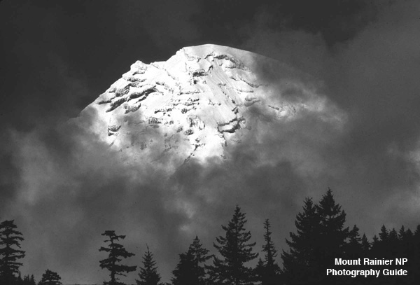
Mt Rainier National Park Photo Places
MPG V2.8, January 2013
Introduction
If you have made the decision to visit Mt. Rainier National Park (NP), the next question is the obvious one, where? This decision really depends on where you are starting from and how much time you want to spend in the car travelling to and in Mt. Rainier NP. I have a visitors guide to the four different entrances. It would help to get out a road map to see the places, distances, and roads on your way.
Overview
To start with a planned trip, there are the four entrances, and unless you want to do to three-quarters circumnavigate trip, which is a very long day in the car, you should decide on one entrance and focus your time on the views, hikes, and photo opportunities in that area.
If you come from Seattle, that means focusing on the eastern half, the White River Entrance, or the northwest quadrant, the Carbon River and Mowich Lake areas, from Tacoma the western half, the Carbon River and Nisqually Entrances, and from Portland, the Nisqually entrance or the Ohanapecosh Entrance.
If you have more time than a day or so, then you can find accomodations in or near the NP where you can explore other entrances or take more time in a particular area. There are many miles of trails you can hike into the NP away from the crowds and get some excellent photo ops.
And some areas have great easy access photo ops, such as, lakes and waterfalls. And don't forget the many turnouts and viewpoints in the NP and on the roads around the NP many stops and places are described and located in the guide to road trips in and around Mt. Rainier NP.
Information
Ok, that said, what is there? Some Websites with overview and trail information and maps are NPS Trail Guide, Visit Rainier, Wiki Travel and National Park Service.
Places
Below is a brief description with information and resources of the places available within a short drive from the four entrances and in and around the Paradise visitors area. In addition, some roads and facilities were damaged from the winter storms of 2006 and 2008 have been repaired some facilities will not be rebuilt and some roads have seasonal closures, or scheduled closures for repairs from previous winter floods, landslides, etc., or for normal maintenance.
Northeast
Northeast.-- The most popular entrance is the White River entrance, the closest to Seattle. This is also the road to the Crystal Mountain Ski Resort before the entrance to the NP. The highway continues along the NP to Chinook and Cayuse Passes and to Highway 123 to the the Ohanapecosh Entrance and the Stevens Canyon highway to Paradise.
There are numerous trailheads off the highway from the White River entrance to the road to the Sunrise visitors areas and to Chinook pass, where you can drive over Cayuse Pass to eastern Washington or on Highway 123 to the Stevens Canyon and Ohanopecosh entrances. There are numerous trailheads on the White River road to the White River campground and on to Sunrise, many with turnoffs for views and short hikes to panoramic views of Mt. Rainier.
Additional information on the Sunrise Area provides lots of photographic opportunities, many of which are accessible via short hikes. It is highly recommended to understand and use the hiking tips for your hikes.
Southwest
Southwest.-- The next most popular entrance is the Nisqually entrance, the closest to Tacoma. This entrance has more visitors areas including the shortest drive to Paradise. However, many of these areas were severly damaged in the winter later storms and floods of 2006 and later years, some facilities won't be repaired or rebuilt, such as the Sunshine point campground. But that said, it shouldn't discourage a photographer from visiting these areas.
The first area just inside the Nisqually entrance is the now permanently closed Sunshine campground where you can get good views of the Nisqually River and the forests in the NP. This place also affords a great place to access the lower Nisqually River area and trailheads. The second area is the Westside Road, which is a trailhead to many other trails, such as the Tahoma Creek trail, Gobblers Knob trail and the Puyallup River basin trails.
The third area is the Longmire Area. This also is an excellent opportunity for photographers along with the visitor services available there (hotel, restaurant, store, and visitor center). There are many trailheads at or near Longmire for shorter day hikes and longer hikes into the higher elevations.
The next area is the road from Longmire to Paradise. There are numerous turnoffs for vistas and viewing, trailheads, and waterfalls. When you plan the trip, it's not unusual to spend the day getting to Paradise along with a day at Paradise, so planning your time is helpful. It's easy to lose track of time at each place and lose track of the time you planned there.
Southeast
Southeast.-- The third popular entrance is the Ohanapecosh entrance, accessible from highway 12 from Interstate 5 between Portland and Tacoma-Seattle. This area is the least visited by visitors because of its inaccessibility from Seattle and Tacoma and from seasonal closures or occasional closures from damage or for repairs.
There is however, some excellent different photographic opportunities from the Ohanapecosh area, and time should be scheduled to visit many of the visitor areas and trailheads. In addition, the Stevens Canyon road offers many vistas, turnoffs and trailheads, including the most photographic place in Mt. Rainier NP, Reflection Lake.
If you plan to photograph Reflection Lake and nearby Lake Louise , as they say, timing is everything, and usually the best time is just before or at sunrise, and occasionally sunset. This place is close to Paradise, and accessible from the Nisqually entrance by turning onto the Stevens Canyon highway before reaching Paradise. In addition there are several excellent short hikes between the lake and the highway to the entrance, such as the Box Canyon and Cougar Falls hikes.
Northwest
Northwest.-- The last entrance is the Carbon River entrance, which is close to both Seattle and Tacoma, but only through local highways and roads. Besides access to the Carbon River Road (closed at the NP entrance), you can take the alternate road to Mowich Lake. This area has some excellent hikes and photographic opportunities from the campground and parking area to upper elevation meadows at Spray Park.
As said the Carbon River Road is closed at the NP entrance, and some of the trail may not have been sufficiently rebuilt to be an easy hike. It is a significant hike into the upper reaches, so you have to plan accordingly. And being the least accessed trail, you'll easily have a quiet hike meeting few people with many photographic opportunities of the river and forests. You will need a backcountry permit to camp at the Ipsut campground.
Paradise
Paradise.-- The Paradise visitors area, which is accessible from three entrances but not via the Stevens Canyon Raod during the fall through 2013 for major road construction, is the most visited area in the Park. Currently there is limited parking and a shuttle service is available from nearby parking areas at Ashford and Longmire. Check the NP shuttle guide.
It's easy to spend the day or more at Paradise where you can stay at the Paradise Inn or at Cougar Mountain campground. There are plenty of trails at Paradise, most short to vistas, some longer for seeing the surrounding area, and the trail to Camp Muir.
The trail to Camp Muir is open to all without a permit, but only for the day. You must return. To stay at Camp Muir you must have an overnight permit and understand the special rules that apply. Since it is the most used starting point for summit climbs, you have to consider climbers first in your hike there. But it shouldn't stop you if you are fit. There are many photographic opportunities on this trail.
Summary
As you can see the NP is full of places to visit and photograph, whether just for a vacation or visit or for your photography work. If you are visiting from out of state or from another country the hardest part is deciding where to go with the time you have in the NP, and most photographs are taken along the roads in the NP or in the vicinity of the tourist areas, such as Paradise, Longmire and Sunrise.
A few photographers will hike the short distances, most often less than a mile, from trailheads along the roads in the NP or at the tourist areas (above) for specific sites for landscapes (scenic, waterfalls, lakes, etc.), nature (wildflowers), or wildlife scenes. Only a very few will do backcountry hikes to the less photographed places and scenes in the NP.
This means the NP is full of photographic places and scenes and it's just a matter of your interests, time and willingness to go.
Resources
Before you plan your photo locations in Mt. Rainier NP, there are a number of excellent photography books along with photographers' Web sites in photography guide Web page on Mt. Rainier NP to get ideas of places and photographs. Most good bookstores should have these.
- "Mount Rainier National Park", Pat O'Hara and Tim McNulty
- "Wasington's Mount Rainier National Park, Centennial Celebration", O'Hara and McNulty
- "Color Hiking Guide to Mount Rainier", Alan Kearney
- "Mount Rainier National Park, Impressions", Charles Gurche
- "Mount Rainier, Views and Adventures", James Martin and John Harlin III
Please use the contact link to send e-mail.