
Mt Rainier NP Weather Sites and Data
Find weather sites via a map
MPG V2.8, January 2013
After any visitor to Mt. Rainier National Park decides they want to visit the NP, and they have a list of places to go, their next thought is, "So, what will the weather be like when we're there?" To answer that you'll need some information, the general pattern, the current data and the latest forecast. And that is the goal of this and the map Web page, to provide the general data, the latest data and information and links, see bottom of this Web page.
Background
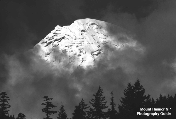
It's always been said that whatever the weather in Western Washington, the Puget Sound, or even the central Cascade Mountains, Mt. Rainier makes its own weather. This is true even in the summer, when the NP gets most of its visitors, from Memorial Day to Labor Day. If you look at the monthly average temperatures for three sites and the monthly extreme temperatures you can see the reason. It can get cold, and sometimes in a hurry, especially at night.
What you need to know is based on the seasons, which divided less by the actual dates of each season and more the common usage, are described below. You should adjust your clothes according to what temperatures you acclimate to where you live or have travelled, but it's always best to follow the layer approach to add or remove layers as needed for the temperatures. And always bring a good rain suit, for the protection and temperature level appropriate for the season.
Seasons
Spring, March through May and Memorial Day, is the last of the snow accumulation in the NP, usually ending between late March to late May, as seen in the graphs for Paradise, at 5,130 feet, and earlier at lower elevations. Any trip in this period should consider encountering rare spring snow storm at higher elevations except in the worst drought years, but always cold temperatures. The weather slowly warms from mid-to-late April through May with occasional unusual late springs storms.
Summer, is obviously the best time to visit the NP, but also busiest. The weather from Memorial Day to Labor Day is best described as variable. It's not likely you'll be snowed on, but cold and rain are always possibilities, even in July and August, the driest months. And for the elevations 2,500 and up, it's usually cold at night. Your best bet is to prepare for cool to warm daytime temperatures and cool to cold at night.
Fall, Labor Day through Thanksgiving Day, is usually the transistion period, although we can easily have an Indian summer through September and into October. However, normally, and often earlier, the cooler to colder and rainy weather of fall starts sometime mid-to-late September and is in full force by mid-to-late October. November is the most variable month for rain, as noted in the winter 2006 and 2008 record storms and floods in the NP.
Winter, December to April-May, is for those serious about winter. The snowpack normally starts in November as the freezing and snow levels falls to the 2,500 elevation early in winter, becoming a seasonal fixture by December. After that it's snow, often down to the lowest elevation in the NP (1,750 feet). It's the time the NP goes into winter recreation rules with seasonal road closures and temporary closures of the Longmire to Paradise road.
Data Collection
The elevation of Mt. Rainier NP ranges from about 1,760 feet elevation at the Carbon River entrance in the northwest and the Ohanapecosh entrance in the southeast to the summit of Mt. Rainier at 14,410 feet (+/- a foot or so). The five entrances vary in elevation from the lowest at those two entrances to the Nisqually entrance (southwest) at 2,000 feet, the White River entrance (northeast) at 2,760 feet, and the Mowich Lake entrance (northwest) at 3,200 feet elevation.
So what does this mean? It involves the business of operating and maintaining weather instruments, data collection systems and real-time telemetry equipment. In Western Washington and more so the Cascade Mountains (including Mt. Rainier) it is difficult to operate and maintain the instruments and equipment at sites for the various types of weather data, such as temperature, rain, barometric pressure and snow (most common) along with wind, humidity, and other data due to the dynamic weather through the freezing and thawing temperature and rain and snow.
In the Cascades the difficultly is in the range of 1,500 to 2,500 and why most precipiation stations are below 1,500 feet and most snow stations are above 2,500-3,000 feet elevation. The dynamic winter weather causes problems or failures with instruments and equipment and often generates inaccurate data. All data collections sites require routine and emergency service and repair - why real-time telemtry is so important as problems are immediately apparent.
In addition the various federal agencies collecting weather data have different mandates and restrictions as to the location and type of sites they can operate, such as the National Weather Service (NWS) operates temperature and precipitation sites and the Natural Resources Conservation Service (NRCS) operates the temperature and snow sites. The National Park Service and US Geological Survey also operate sites within their mandates.
Weather Sites
The locations of sites collecting weather data in and around Mt. Rainier NP can be found on a map of the sites with links to the respective Website for the site. All of these agencies share data and provide it to the public (part of your tax dollars at work).
As you can see on the map, above link, there aren't a lot of sites, especially with satellite telemetry for real-time data, meaning three - Mowich Lake, Paradise (actually southeast of Paradise) and Cayuse Pass. The other sites are those where data is collected via telephone communications at regular intervals, or reported daily by observers for the respective agency, usually the National Park Service or National Weather Service.
Weather Data
What this means is that you have to use the latitude and location of these sites to interpret the data for your hikes or trips. During the winter this includes the lowest elevation of snow and the snow depth since that data is not collected and can't be reported. It does mean you can use the reported freezing level from the NWS to some degree but this varys every day and during the day along with weather fronts, storms, etc.
During the winter, and more so into December and through February, it's safe to plan temperatures will be at or below freezing except for occasional sunny, warm days above 3,000 feet elevation and below during periods of cold snaps and snow storms. This is why the Nisqually site is useful to see the temperatures and any snow on the ground since this location is open with NPS staff every day and the Ohanaopecosh site is closed in the winter season.
In addition to the weather data you also have the benefit of the array of Webcams, see map for their locations, to see the latest conditions in Mt. Rainier NP. This is important as the weather can be different around the mountain from clear to socked in clouds or fog, sometimes not obvious from the weather data or seeing the mountain from a distance.
Personal Notes
On a personal note, please thank the field personnel of the federal government agencies for their dedication to service these sites, instruments and equipment to provide the best data for you. I've been there, worked with many, and talked to others in my career. They're great people doing a great, and often a really fun job.
Additional Resources
The next important information is where to find information and links, which are listed below.
- Books in Print
- Northwest Mountain Weather by Jeff Renner
- Pacific Northwest Weatherby Cliff Mass
- Websites
- NPS NPS Information
- NWS Mountain Forecast
- NRSC Snotel Sites
- NWAC Mountain Data
- USGS Weather data
Please use the contact link to send e-mail.