
Mt. Rainier NP Temperature and Precipitation Data
Find weather data via a map
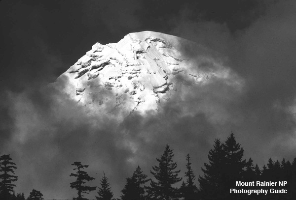
MPG V2.8, January 2013
One of the most important factors when planning your trip to Mt. Rainier National Park is the obvious, the weather. To first-time and even the occasional visitors, but especially long-time and frequent visitors, it's important to know the weather in Mt. Rainier NP is so dynamic that forecasts are at best just that, best guesses, and even the latest forecast is only a close proximity of reality. It's the old adage of weather folks here, "Mt. Rainier makes its own weather."
So, it's the normal "be prepared for the extremes" for the period of your visit. But that said, recent data and forecast is a place to start to plan your visit, and this entry will provide some resources to find the most recent weather information and forecasts. These will be listed as Websites where you can search for the specific site(s) and data along with some general weather data.
When you get close to the time of your visit to Mt. Rainier NP, the first place to start is the current weather and latest forecasts, which are explained in the book Northwest Mountain Weather. After that, you need some on-line resources with weather data, information and forecasts, which are listed under below.
There are many more on-line government and commercial resources for weather data and information on or around Mt. Rainier NP, but the ones above will give you a good idea of what to expect and get the latest data and forecasts. The next thing is to understand are the seasons, especially if you plan to be there between late fall and early summer.
This is because it's not about the normal seasonal late spring to early fall weather when the temperatures are usually more moderate and somewhat more predictable, meaning it won't get too cold except at higher elavations in the backcountry. This is shown in the average monthly temperatures for Longmire, Paradise and Ohanapecosh.
Below are tables with additonal data for Longmire and Paradise. This data are the average high and low temperatures and the extremes of high and low temperatures, along with the average precipitation and precipitation as snowfall along with the record snowfall.
This can occur at almost anytime of the year, but not normally late spring to early fall and not always in significant quantity from early fall to late spring. This means it can get cold enough to snow almost anytime during the year and warm enough to rain anytime during the winter. This is seen in the snowfall and snow water equivalent, for Paradise, the latter being snow reduced to water and converted to equivalent precitation.
Weather Data
Below are the monthly data for Longmire in the southwest corner of the NP just east of the Nisqually entrance and for Paradise in the south center area of the NP south of the crest of Mt. Rainier. The data is for the period 1971-2000 except as noted for the record snowfall for the period of the record of each station.
Weather Data, Longmire, WA
Lat. 46°, 45' N, Long. 121°, 49' W, Elev. 2,762 ft.
| Temperature and Precipitation Data** |
|||||||
|---|---|---|---|---|---|---|---|
| Month | Average Low |
Average High |
Lowest Temp. |
Highest Temp. |
Average Rainfall |
Average Snowfall |
Record** Snowfall |
| January | 24° | 36° | -9° | 60° | 10.8" | 48.4" | 152" |
| February | 26° | 40° | -8° | 64° | 8.9" | 37.6" | 123" |
| March | 28° | 44° | -1° | 73° | 8.1" | 32.2" | 132" |
| April | 32° | 53° | 12° | 83° | 4.9" | 9.0" | 49.5" |
| May | 37° | 62° | 21° | 95° | 4.0" | 0.7" | 19.0" |
| June | 43° | 66° | 28° | 96° | 3.6" | Trace | 0.5" |
| July | 47° | 75° | 35° | 105° | 1.4" | 0" | 0" |
| August | 47° | 74° | 33° | 100° | 1.6" | 0" | 0" |
| September | 43° | 68° | 28° | 97° | 3.9" | Trace | 1.5" |
| October | 38° | 57° | 17° | 88° | 8.6" | 1.4" | 14.0" |
| November | 31° | 45° | -3° | 72° | 11.5" | 14.4" | 68.0" |
| December | 28° | 35° | -1° | 60° | 13.7" | 34.0" | 115" |
** - Weather data for period 1971-2000 except as noted with Record Snowfall which is 1908-2011.
Weather Data, Paradise, WA
Lat. 46°, 47' N, Long. 121°, 44' W, Elev. 5,550 ft.
| Temperature and Precipitation Data** |
|||||||
|---|---|---|---|---|---|---|---|
| Month | Average Low |
Average High |
Lowest Temp. |
Highest Temp. |
Average Rainfall |
Average Snowfall |
Record** Snowfall |
| January | 21° | 33° | -14° | 62° | 14.5" | 118" | 360" |
| February | 22° | 35° | -12° | 62° | 10.6" | 88.7" | 232" |
| March | 22° | 37° | -2° | 65° | 10.4" | 98.6" | 242" |
| April | 27° | 44° | 2° | 70° | 6.7" | 54.1" | 170" |
| May | 33° | 50° | 14° | 88° | 4.4" | 21.3" | 71.9" |
| June | 37° | 56° | 13° | 86° | 4.7" | 4.3" | 47.5" |
| July | 44° | 64° | 20° | 87° | 1.7" | 0.3" | 10.7" |
| August | 43° | 63° | 24° | 92° | 2.6" | Trace | 6.0" |
| September | 39° | 57° | 18° | 89° | 6.9" | 5.2" | 38.0" |
| October | 33° | 48° | 2° | 79° | 12.0" | 22.0" | 85.5" |
| November | 27° | 41° | -11° | 78° | 14.5" | 64.9" | 215" |
| December | 22° | 34° | -20° | 62° | 16.6" | 105" | 268" |
** - Weather data for period 1971-2000 except as noted with Record Snowfall which is 1915-2011.
Personal Notes
This means you should always plan for the widest weather when you'll be there, get the most recent information weather, be prepared for quick and severe changes in the weather and conditions and be flexible with your plans and schedules, especially when and where the NPS issues advisories or implements emergency rules.
Resources
- Books in Print
- Northwest Mountain Weather by Jeff Renner
- Pacific Northwest Weatherby Cliff Mass
- Websites
- NPS NPS Information
- NWS Mountain Forecast
- NRSC Snotel Sites
- NWAC Mountain Data
- USGS Weather data
Please use the contact link to send e-mail.