
The 1896 Expedition
Find expedition locations via a map
MPG V2.8, January 2013
Introduction
In 1896 a team of USGS geologists conducted a reconnainssance of the glacers and geology of Mount Rainer. Their two week expedition, July 15-31, 1896, started at Carbonado, travelled the established Bailey Willis trail up the Carbon River to the terminus of the Carbon Glacier and established a camp at Philo Falls. After two days for side trips they did a traverse of the north side of Mount Rainier across the Carbon Glacier through Moraine Park to establish another base camp alongside Winthrop Glacier.
From there five members of the team climbed to Steamboat Prow before doing a summit climb the following day, staying overnight in one of the steam caves, and descending to Paradise Park. They returned to the Winthrop Glacier camp across Cowlitz, Ingraham, Emmons and Winthrop Glaciers, after which they returned to their camp at Philo Falls. After a day's rest, and under the threat from a nearby forest fire, the team split into two groups, one along the Carbon River trail and the other the Grindstone Trail, reuniting on the Bailey Willis Trail to return to Carbonado.
The team consisted of Bailey Willis, geologist, Israel C. Russell, geologist, team leader and lead climber, George O. Smith, geologist assigned to collect rock samples, George Landes, geologist, F.H. Ainsworth, Michael Autier, Fred Koch and Williams Williams, team assistants, and Hope Willis (age 10), Bailey Willis' daughter.
Expedtion Timeline and Locations
Below are the dates of the team's travel and base camps or overnight stays for the expedition. Each date is the date the camp or overnight stay was reached by the day's travel or excursions.
July 15, 1896.--The team left Carbonado morning of the 15th along the Bailey Willis Trail. This trail was established in the early 1880's, and no longer exists except for short segments incorporated into local trails or roads. The camp location was undocumented.
July 16, 1896.--The team continued enroute on the Bailey Willis Trail. The camp location was undocumented.
July 17.--The team travelled on Bailey Willis Trail up to about the present day boundary of Mt. Rainier NP. The group spent the night at Carbon River shelter. This location is suggested in the report they had travelled to about the present day boundary of the National Park where a cabin had existed since the establishment of the Bailey Willis trail.
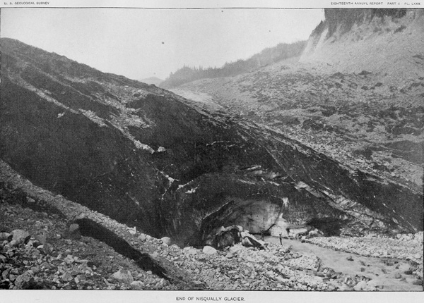
July 18.--Leaving the Carbon River shelter and travelling up the Carbon River trail, the group split at Chenius Falls, the supply team with the mules travelling up the right bank of the Carbon River to the base of the Carbon Glacier and the geologists and others travelling up the left bank to establish a camp at Philo Falls. The expedition team established a camp at Philo Falls while the supply team camped at the terminus of the Carbon River Glacier and returned to Carbonado. (Note.--Left and right bank are relative to looking downstream.)
July 19.--Nothing is documented for this day at the Philo Falls camp, but reason would suggests they established the camp and ferried supplies from the drop at the terminus of the Carbon Glacier, and perhaps conducted short excursions in the vicinity of the camp.
July 20.--The expedition team explored the area southwest of the camp up through Spray Park to Knapsack Pass and down to Mowich Lake, returning to camp via Eagle Cliffs and the Guardian Rocks.
July 21.--Leaving the camp at Philo Falls, the team travelled across the Carbon Glacier at Goat Island up to and across Moraine Park and then up to the western edge of Winthrop Glacier to about the 7,000 foot elevation level near treeline. The same day the team crossed the Winthrop Glacier to explore the glacier and geology.
July 22.--The team explored the upper divide between the Wintrop and Carbon glaciers below Curtis Ridge (north of Willis Wall), down the east side of Carbon Glacier and back through Moraine Park to Old Desolate and back to the camp.
July 23.--From the Winthrop camp five of the team (Willis, Russell, Smith, Williams and Ainsworth) left with just blanket, rations and minimal supplies for a summit climb and exploration of the east side glaciers. The rest of the team stayed at the camp for the duration of the time, but no record has been found documenting their activities outside those of Bailey Willis' daughter Hope. The summit team got as far as Steamboat Prow for an overnight stay.
July 24.--The team left their supplies and blankets at Steamboat Provw for the summit climb. Nothing in the report and documents indicates any clear route they took except up Emmons Glacier. Upon reaching the crest of the crater late in the day, they stayed overnight at one of the steam caves.
July 25.--After hiking around the crater to Columbia Crest and the west side, the team descended via the then established climbing route going by Gibraltar Rock and Camp Muir to Paradise Park. At Paradise Park they meet with people camping there and stayed overnight for their return traverse across the east side of the mountain, across four glaciers.
July 26.--They originally planned to get back to the Winthrop Glacier camp in one day but the route proved difficult. By late in the day after passing near Anvil Rock and/or Camp Muir - it isn't clear in the report, the team only managed to get to the west side of Ingraham Glacier near Cathedral Rocks before encountering an ice wall. They then reversed part of their route and sensing the difficulty of finding a camp, they chose to descend Cowlitz Glacier and stay overnight alongside east side Cowlitz Glacier about a mile below Ingraham Glacier, at about 6,200 foot elevation.
July 27.--The team climbed over the cliff above their camp to about the 8,000 foot elevation level on the west side of Little Tahoma where the a ledge was just above the glacier. From there they climbed up along the east side of Ingraham Glacier to the tip of Little Tahoma. Around the tip they dropped down about 2,000 feet along the glacier to cross Emmons Glacier to a nunatak in the center of the glacier and then back up to Steamboat Prow to collect the supplies left July 23rd, before acrossing Winthrop Glacier to the camp along Winthrop Glacier with the other team members.
July 28.--Nothing is documented for this day at the Winthrop Glacier camp. Reason suggests they rested and prepared to return to the Philo Falls camp site.
July 29.--The team left the Winthrop Glacier camp for the Philo Falls camp. They planned some additional side trips from the Philo Falls camp, especially to the glaciers on the west side of Mount Rainier but after hearing reports of forest fires, they rested instead and prepared to leave the area.
July 30.--With threats from nearby forest fires in the Carbon River valley the group split, the supply team taking the Carbon River trail to the Bailey Willis trail, and the team of Russell and Smith going via Spray Park, Ptarmigan Ridge and Mowich Lake before travelling the Grindstone trail to the Bailey Willis trail. In both cases the camps along their return route were undocumented.
July 31.--Both teams arrived at Carbonado. Nothing is documented with details of their route or camps once they left the (NP) area.
Summary
When they returned to Carbonado, the expedition team had accomplished many of their goals. They explored and examined many glaciers and the geology of Mount Rainier from Mowich Lake and the upper Puyallup River area around the north and east side of the mountain to Paradise Park. This included seven major glaciers. George Smith collected 23 rock samples and did more rock examinations.
Although much of their interpretation of M. Rainier has been revised or replaced with later scientific explorations and investigations of the mountain, they have to be given considerable credit for their endeavor and accomplishments for the day. They established the enormous scientific importance of Mt. Rainier and the area and preserving it as a National Park.
In addition, a lot of credit belongs to Bailey Willis who worked for the railroad around Mount Rainier 1880-1883 and with other geologists, including George Smith and Israel Russell, conducting geologic explorations of the Washington Cascade Mountains and Puget Sound with the USGS in the 1890's. He was also one of the key figures with the National Park designation effort in the 1890.
Additional Resources
Numerous resources were used in the research for this set of Web pages, and the research is still being done to correct and improve the information. It's a living project and will be updated as I find new material and documents. To date these include the following primary sources, listed below, with the rest listed in the book resources Web page.
- "Glaciers of Mount Rainier", Israel Cook Russell, 18th Annual Report, 1896-97, Part II, pages 349-415.
- "The Rocks of Mount Rainier", George Otis Smith, 18th Annual Report, 1896-97, Part II, pages 416-423.
- "Impressions of Mount Rainier", Israel C. Russell, Scribner's Magazine, Volume 22, page 169-176, 1897.
- "Mount Rainer, A Record of Exploration", Edmond S. Meany, The MacMillan Company, 1916.
- "Among the Cliffs of the Northern Spine Mount Tacoma (Rainier)", Bailey Willis, unpublished, 1882.
- Field Notes on Geology and Rock Samples, G. O. Smith, Field Books, USGS, Aug. 1895 and July 1896.
- Personal Correspondence, Bailey Willis, Huntington Library, July 29 and August 2, 1896.
Please use the contact link to send e-mail.